Every habitat visit tells a story. Make sure yours is on record.
Ecological restoration work is only as credible as the records behind it. SiteMarker makes sure every monitoring visit, every photo point, and every compliance report is documented before you leave the site.
Over 3,000 projects managed daily by firms across the country


Use Cases
From Visit to Compliance Record, Before You Leave the Field
Regulatory Compliance Site Visits
Document site conditions against permit requirements in real time. Every finding is timestamped, geo-referenced, and tied to the specific monitoring point on your plan, so your compliance record is audit-ready before you get back in the truck.
Mitigation Monitoring Reports
Generate USACE-compliant monitoring reports directly from the field. Document vegetation cover, hydrology indicators, and invasive species conditions with geo-referenced photos and notes, pinned to exact monitoring stations on your plan.
Native Plant Establishment Surveys
Record species presence, survival rates, and planting condition at each monitoring station directly on your map. Build a geo-referenced baseline that shows regulators exactly where success criteria are being met.
Pre-Construction Condition Surveys
Document baseline site conditions before any earth gets moved. Capture existing vegetation, hydrology, and habitat features with geo-referenced photos and notes, building a defensible pre-disturbance record that anchors every monitoring visit that follows.
Your current reality
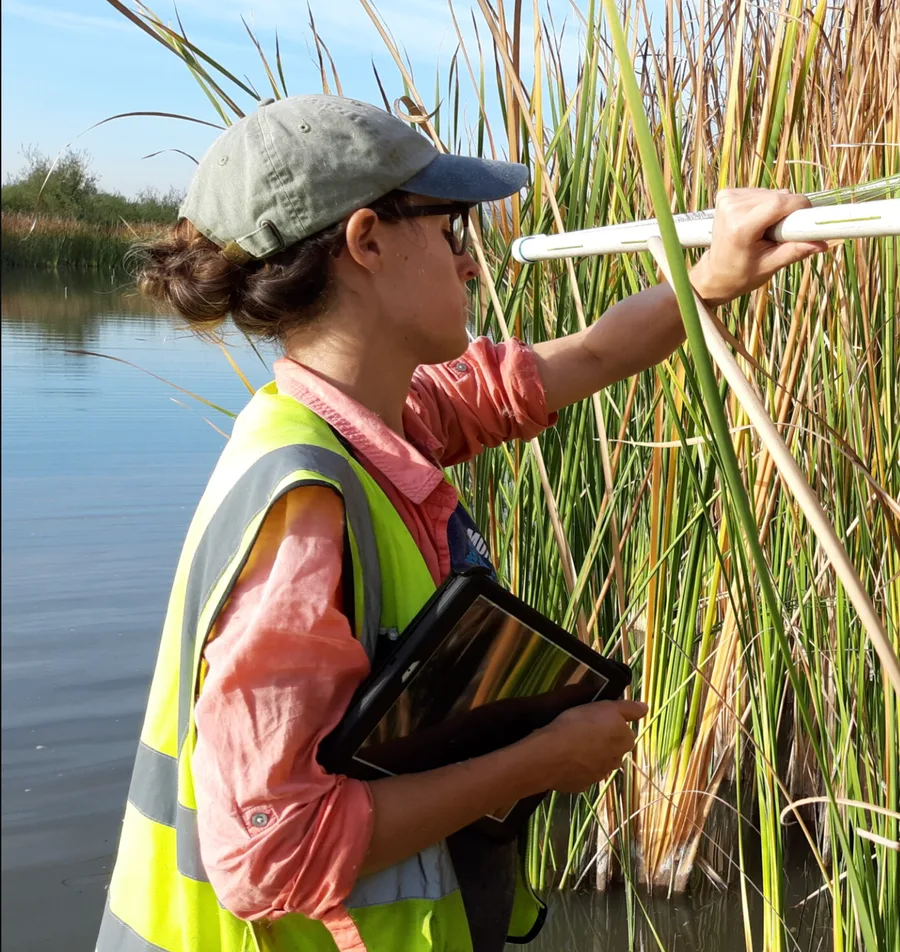
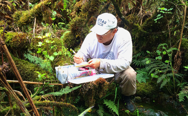
Ecological restoration happens in the field.
Your documentation shouldn't happen at your desk.
In the Field
Walking transects, photographing monitoring points, taking notes. None of it ends up in the order your report needs.
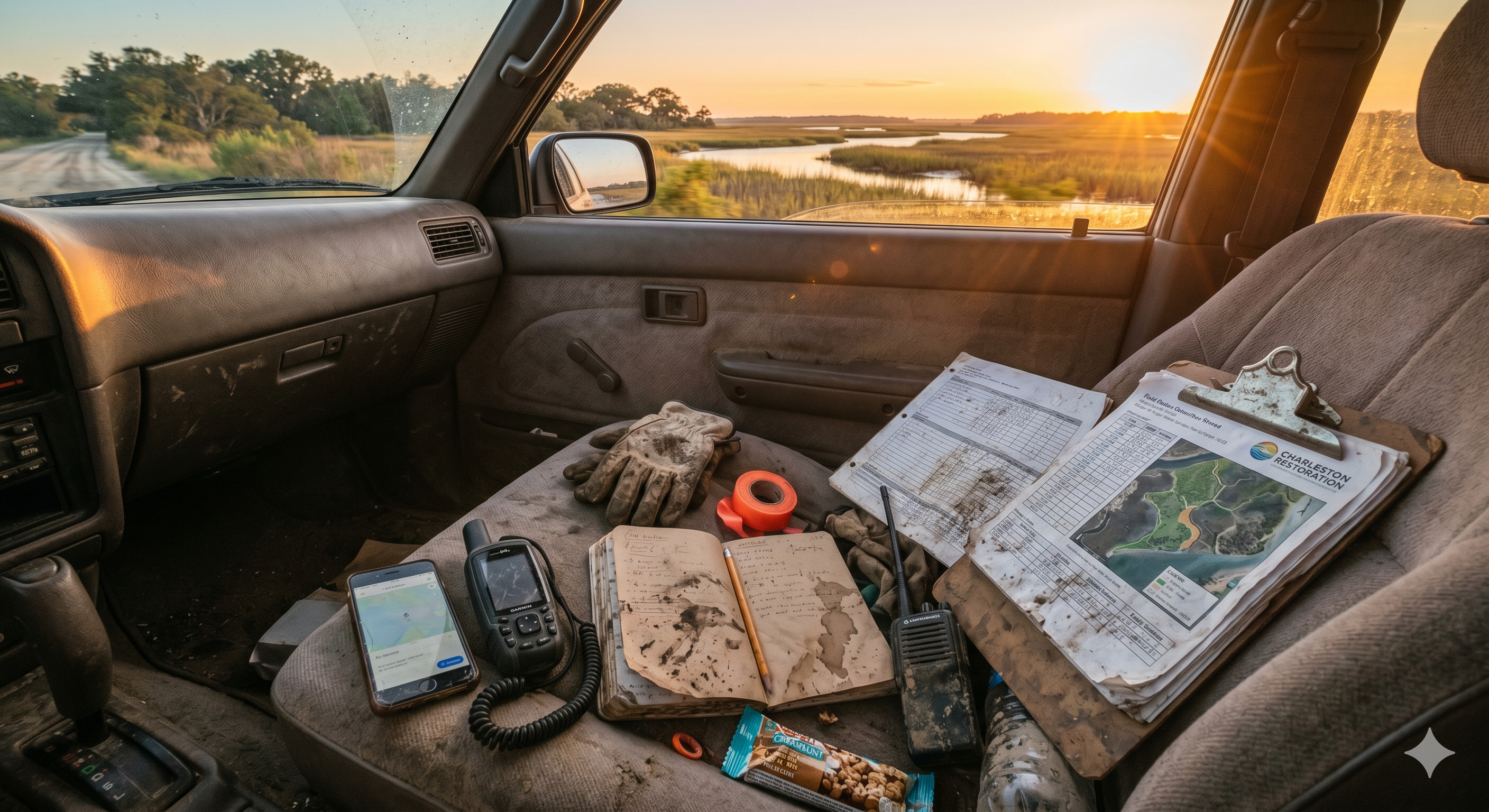
On the Drive Back
Stitching together which photos belong to which station. Hoping GPS tags hold up if a regulator ever asks.

At Your Desk
Rebuilding the visit from scattered photos and memory. Cross-referencing timestamps against a hand-drawn site map.
Your regulator doesn't care how hard the field work was. They want a defensible record. SiteMarker builds it automatically as you walk, so compliance documentation is a by-product of the site visit, not a separate job.
What poor field documentation actually costs a restoration project.
The field work meets permit requirements. The documentation doesn't. That gap is where projects stall, re-visits get triggered, and compliance windows close.
25 hrs/report
average time environmental consultants spend per Phase I ESA. Mitigation monitoring reports demand comparable hours, multiplied by stations and years.
71% failure rate
for forested wetland mitigation projects. When outcomes are uncertain, your documentation is your only defense.
5–10 long years
of monitoring required on USACE-permitted mitigation projects. Weak documentation compounds into liability across the full permit period.
of USACE permit files contained evidence of a compliance inspection.
GAO-05-898, Wetlands Protection (2005). When agency oversight is thin, your documentation is the project's only record.
Sources: SCS Engineers, “Balancing Costs and Liabilities for Consulting Firms in Phase I Environmental Site Assessments” (industry cost analysis). Matthews, J.W. & Endress, A.G., “Performance Criteria, Compliance Success, and Vegetation Development in Compensatory Mitigation Wetlands,” Environmental Management 41, 130–141 (2008). 33 CFR Part 332.6, USACE Compensatory Mitigation for Losses of Aquatic Resources. U.S. Government Accountability Office, Wetlands Protection: Corps of Engineers Does Not Have an Effective Oversight Approach (GAO-05-898, 2005).
Ecological restoration field documentation, simplified
From monitoring station to compliance report, without going back to the office.
From the moment you step onsite, SiteMarker is building your monitoring record. Document conditions as you walk each transect, and leave with a geo-referenced, permit-ready report before you reach your vehicle.
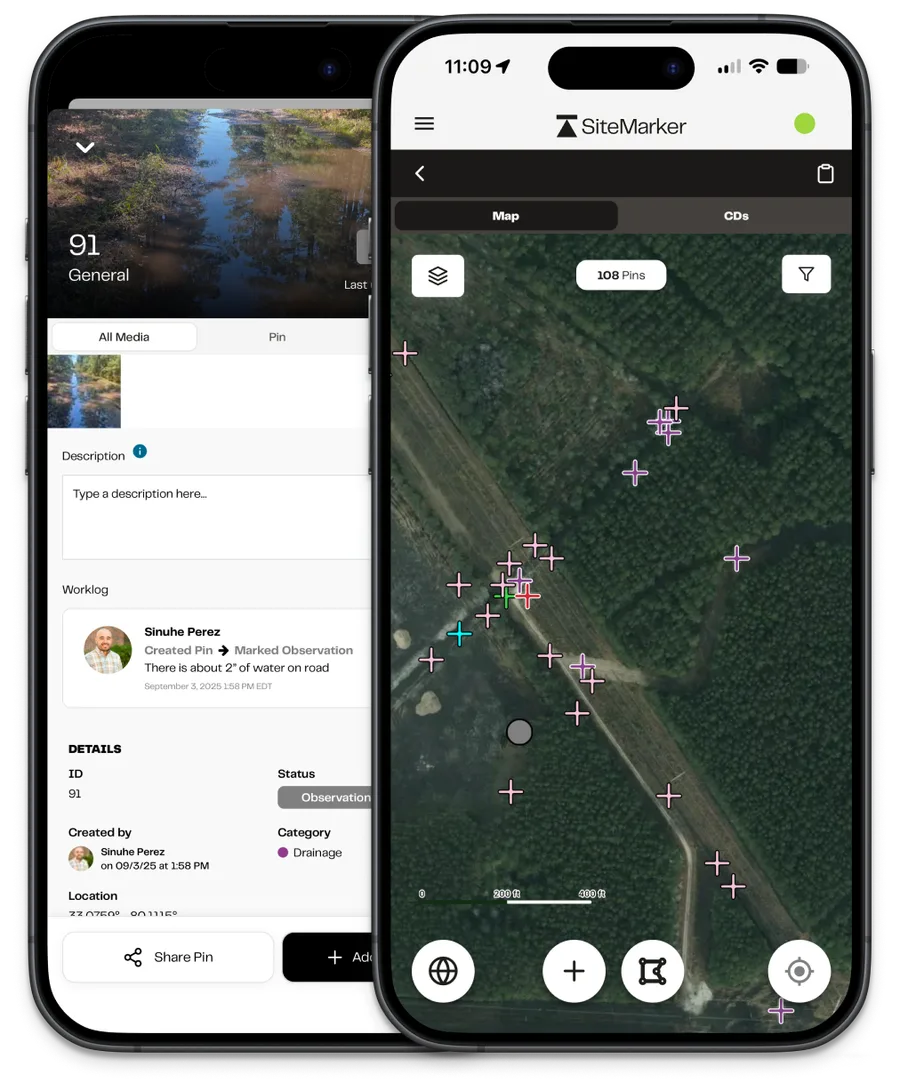
Locate
Walk your monitoring transects with the restoration plan already loaded. Every observation drops onto the exact monitoring station or polygon on your map. No re-matching coordinates after the fact.
Document
Pin each monitoring station, attach photos, and record vegetation cover, hydrology conditions, and invasive species findings as you walk. The compliance record builds with every step.
Report
Select your monitoring stations and the report generates in seconds. Geo-referenced, photo-documented, and formatted for regulatory submittal. Done before you leave the restoration site.
Submit
Share compliance reports with USACE, state agencies, or mitigation bank sponsors directly from the field. No desk time, no reformatting. One tap, one deliverable.
Built for Ecological Restoration
What happens between the monitoring visit and the regulatory submittal shouldn't take days.
Monitoring Station Mapping
Load your restoration plan and establish permanent monitoring stations directly on the map. Walk back to the exact same point every monitoring cycle with GPS guidance to sub-meter accuracy. Your baseline is always where you left it.
Instant Compliance Reports
Select the monitoring stations you visited and generate a formatted, photo-forward report in seconds. Structured for regulatory submittal, complete with geo-referenced pins, condition notes, and timestamped photos. No desk time required.
CAD & GIS Plan Overlays
Import restoration plans, wetland delineation maps, and permit boundary files as live map underlays. Walk the site with your approved design already loaded so every observation is anchored to the permitted design intent.
Geo-Referenced Photo Documentation
Every photo is pinned to its exact coordinate on your plan with a timestamp. When a regulator asks about conditions at a specific monitoring point on a specific date, you have a verifiable, spatially accurate record, not a camera roll search.
Multi-Year Data Continuity
Every monitoring visit builds on the last. Access prior visit records at each monitoring station, track vegetation recovery trends over time, and show regulators a continuous, spatially organized compliance history across the full permit period.
Regulatory-Ready Record Keeping
All pins, photos, reports, and field notes are stored securely and linked to their precise map location. Your project record is audit-ready from day one, not assembled in a panic before the next agency review.
“Just having SiteMarker at our fingertips… we had our defense. It's all here.”
Kyle Ashmun
Ecological Restoration Specialist
Ecosystem Services
Request a Tailored Demo0
Projects Documented
0
Time Saved Per Visit
0
Reports Generated
0
Pins Logged
† SiteMarker platform data, averaged across 4,500+ active projects.
Common questions
Everything ecological restoration specialists want to know about SiteMarker.
How do ecological restoration specialists typically document site conditions during monitoring visits?+
Most field teams rely on camera roll photos, handwritten datasheets, and hand-drawn maps, then spend hours back at the office cross-referencing everything into a formatted monitoring report. Details get lost, photo locations get confused, and the final document is only as good as what survived the reconstruction. SiteMarker replaces that workflow with a geo-referenced, photo-linked site record built entirely in the field.
How does SiteMarker help with mitigation monitoring and compliance reports?+
SiteMarker lets you pin observations directly to monitoring stations on your restoration plan as you walk. Vegetation cover, hydrology indicators, invasive species extent, and photo documentation are all geo-referenced and timestamped as you collect them. When you select your stations, a formatted monitoring report generates in seconds, ready for regulatory submittal before you leave the site.
Can SiteMarker track monitoring station visits across multiple years?+
Yes. Monitoring stations persist between visits, so every annual or semi-annual site visit builds on the existing record. You can access prior condition notes and photos at each station while in the field, making trend comparisons and success criteria assessments part of the monitoring workflow, not a separate office task.
How does SiteMarker support USACE permit and regulatory documentation requirements?+
SiteMarker ties every field observation to a precise GPS location, with a timestamp and the identity of the person who created it. Photos, condition notes, and monitoring findings are all structured and geo-referenced, not scattered across a camera roll. When an agency questions a finding or a permit condition comes up for review, you have a verifiable, time-stamped field record, not a recollection.
What happens if I lose cell service in the field?+
SiteMarker works offline. Your restoration plans, monitoring stations, and prior visit records are all cached on your device before you head into the field. You can drop pins, attach photos, and record condition notes without any signal. Everything syncs automatically the moment you're back in range, so a dead zone in the backcountry doesn't break your documentation workflow or leave gaps in your compliance record.
What our customers are saying.
From the largest firms in the US to growing regional groups, hear how SiteMarker is transforming the way teams document, report, and collaborate on-site.
When in doubt, if something's in question, add the pin as an observation so we can all look at it. SiteMarker really helped us with the sloppiness.

Kyle Ashmun
Stream Restoration Specialist
Ecosystem Services
SiteMarker made my life much more simple. It played a role in keeping things from getting too far out of hand and keeping corrective action moving forward.

Jon Roller
Co-Founder & Principal Soil Scientist
Ecosystem Services