Your field work deserves better
than a clipboard and a prayer.
SiteMarker connects geo-tagged documentation to your project plans so your team can locate, document, report, and take action. In real time, from anywhere on site.


All in one
All your information, in one place.
Your team shouldn't need eight apps to run one job site. SiteMarker pulls maps, photos, inspections, and reports into a single workflow, so crews capture once in the field and the office sees it the moment it happens. Faster handoffs, fewer errors, total transparency.
One place for all your project data.
Sound familiar?
You know the routine.
Walk the site. Take photos on your phone. Scribble notes on a plan that's half-soaked from the rain. It's not that your team lacks discipline. It's that the tools haven't caught up to how construction actually works.
Photos with no context
Hundreds of site photos scattered across personal phones, emails, and chat threads. No location, no plan reference, no searchable record.
Notes that disappear
Scribbled plans, half-legible field notebooks, and voice memos nobody transcribes. Context lost before you get back to the truck.
Reports built from memory
Hours piecing together what happened, where, and when. Reconstructed at the end of the day from a camera roll and a best guess.
No proof when it matters
Disputes happen. Regulators audit. When they do, the question isn't whether the work was done. It's whether you can prove it.
Setup
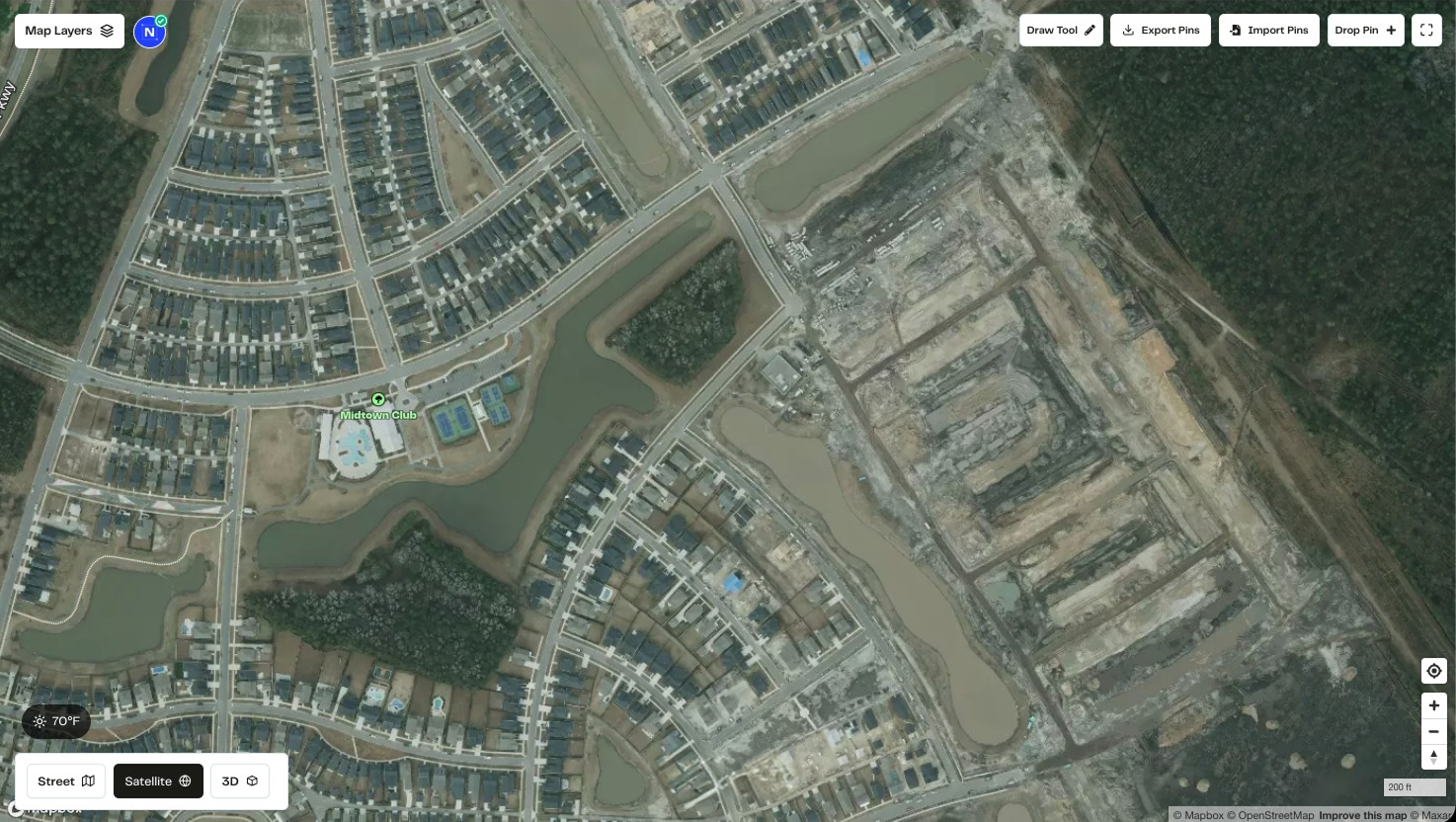
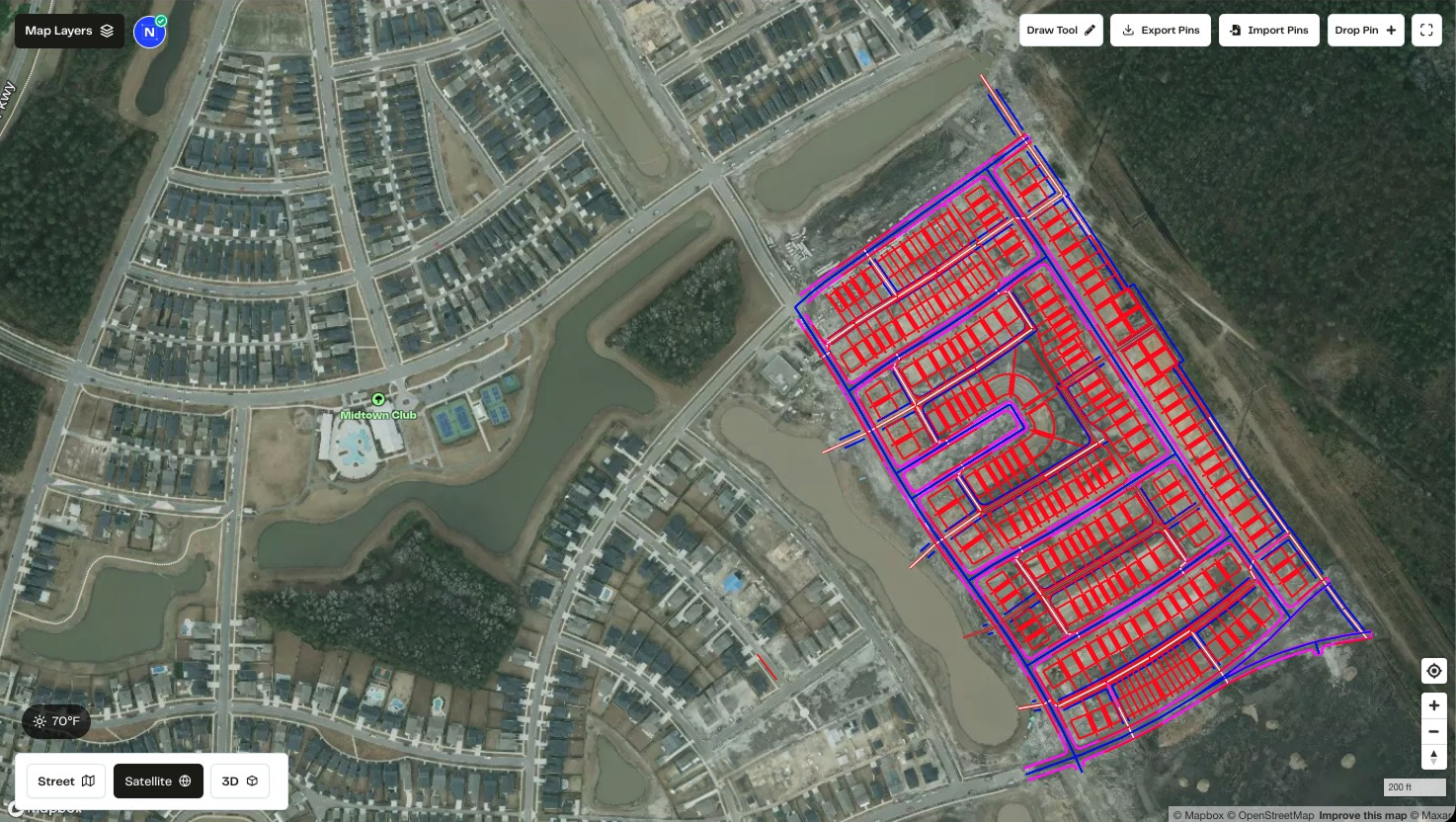
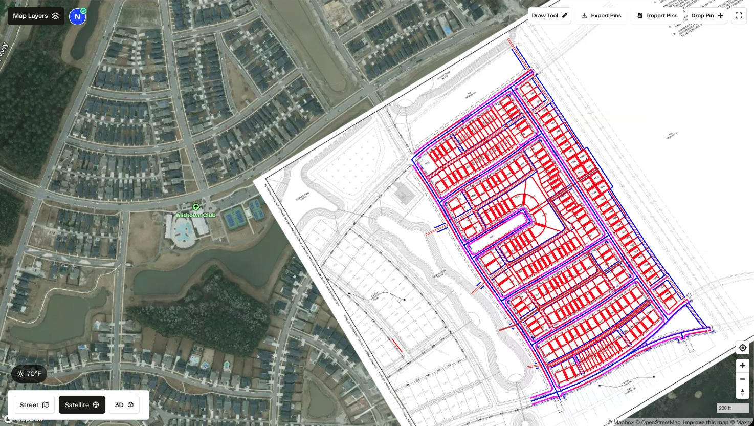
Import your project plans.
Upload KML, KMZ, drone TIFFs, PDFs, or images. Files with embedded coordinates georeference automatically; PDFs and images you place manually.
Familiar workflow. Better records.
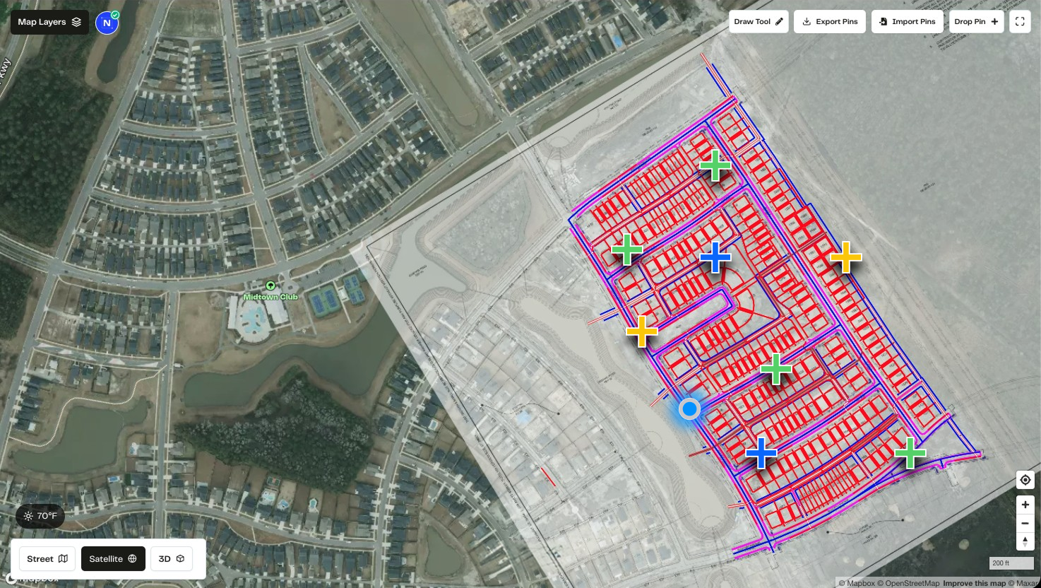
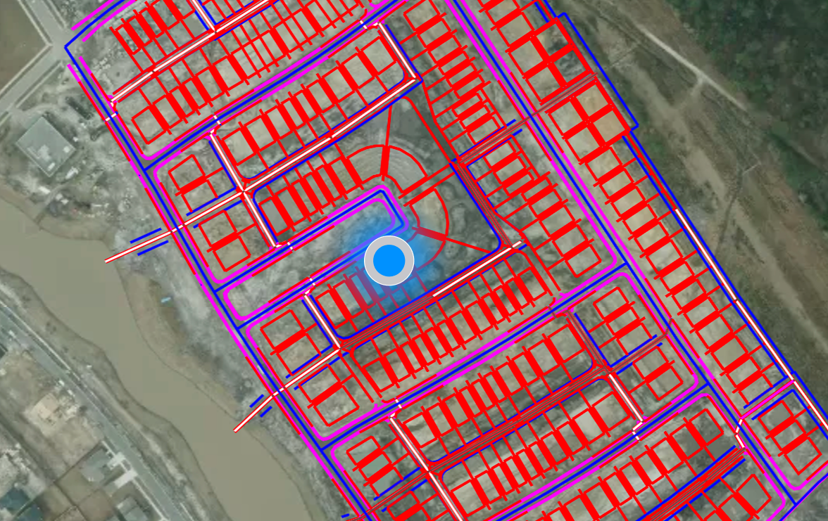
Locate
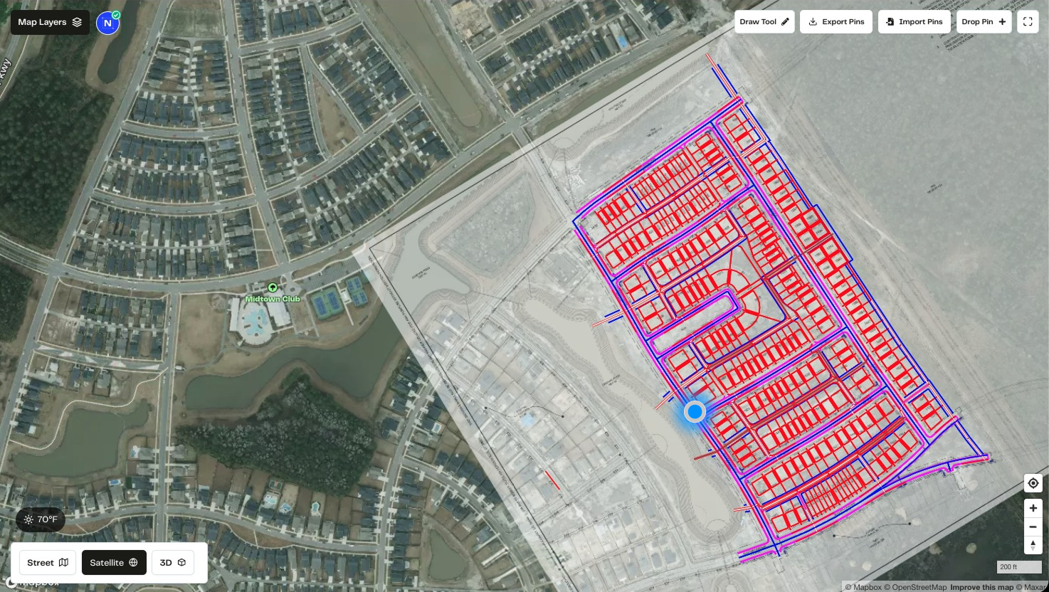
Always know where you are on the plan
Real GPS precision. No guesswork. No manual placement after the fact.
SiteMarker puts you on the map, literally. Open the app, see your real-time position overlaid on your project plans, and drop a pin exactly where you're standing. Every issue, every inspection point, every corrective action is tied to a precise GPS coordinate on the drawing, not an approximation you filled in back at the office.
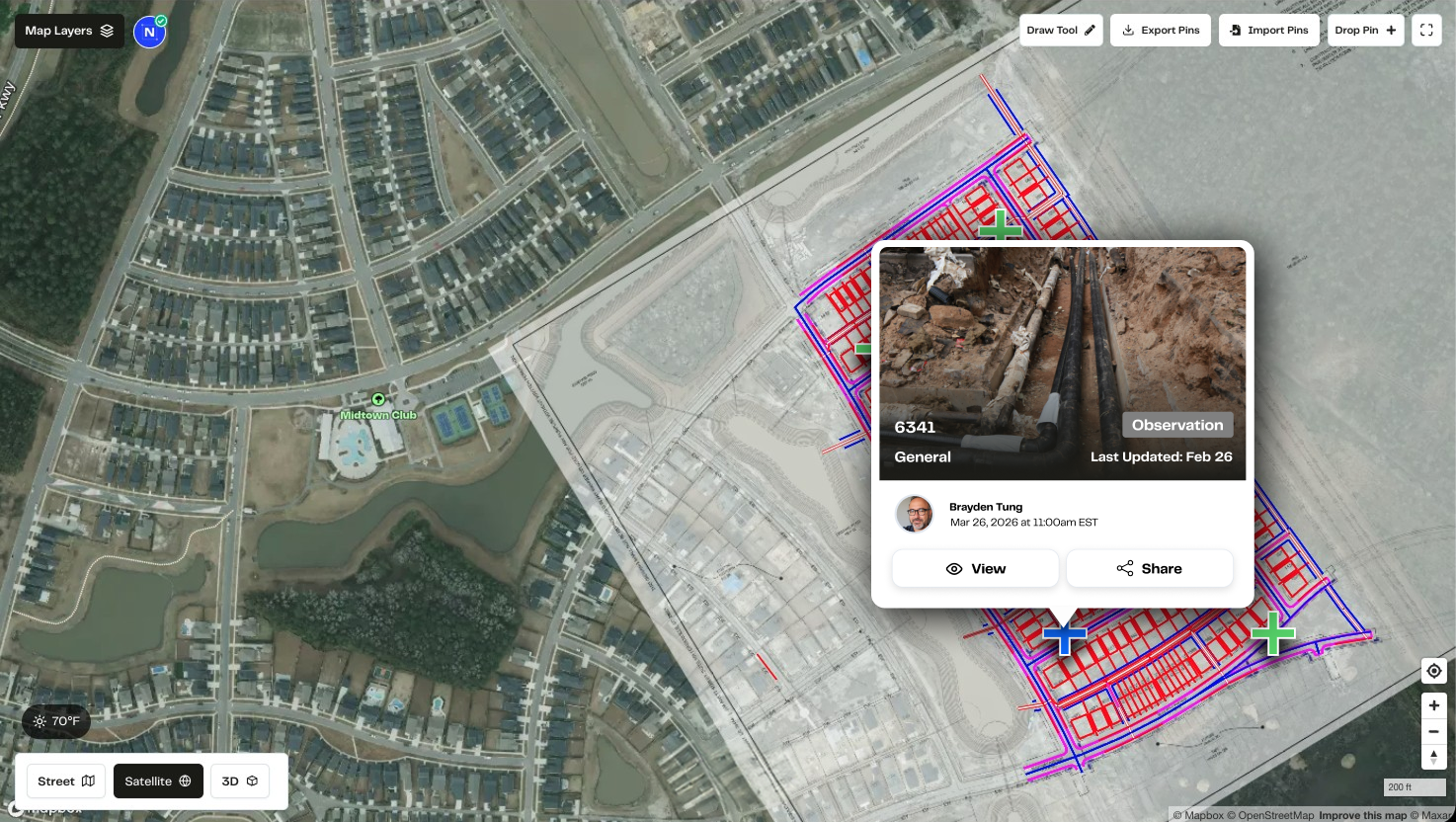
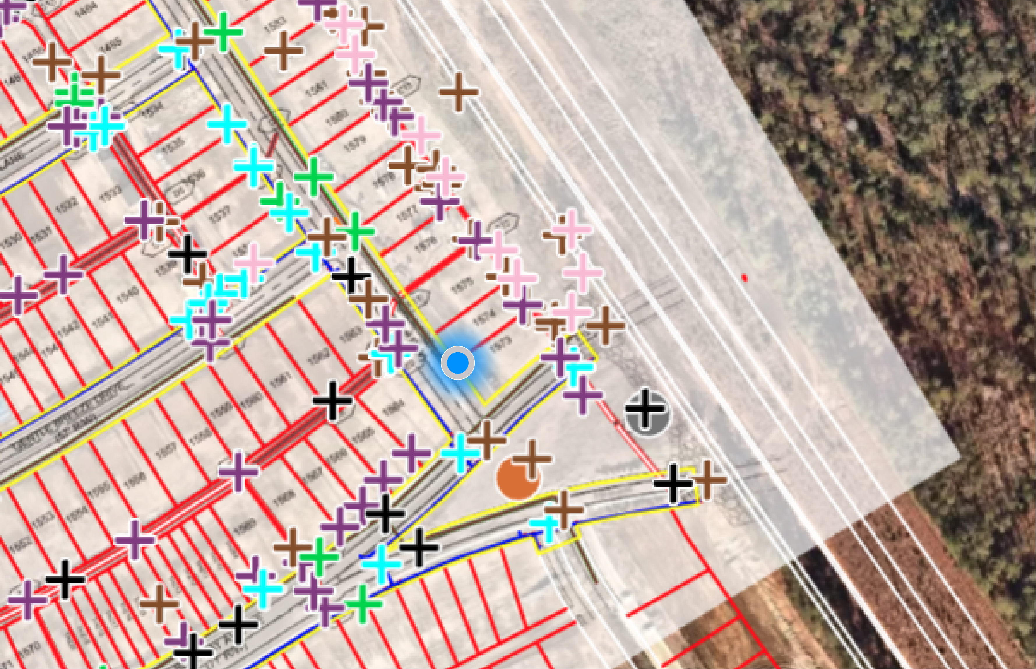
Document
Capture everything while you're still standing there
Geo-tagged photos, notes, and SWPPP records. All in one tap, before you take a single step away.
Drop a pin. Attach a photo. Add notes. That's it. Whether you're documenting erosion controls for a SWPPP inspection, tagging a proofroll issue for a geotechnical follow-up, or capturing a milestone for a DOT progress report, SiteMarker keeps the context attached to the moment, not reconstructed from memory later.
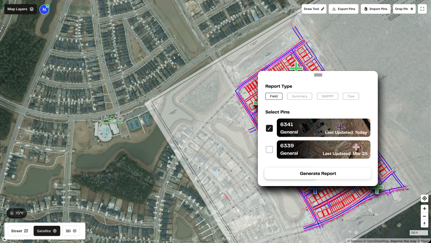
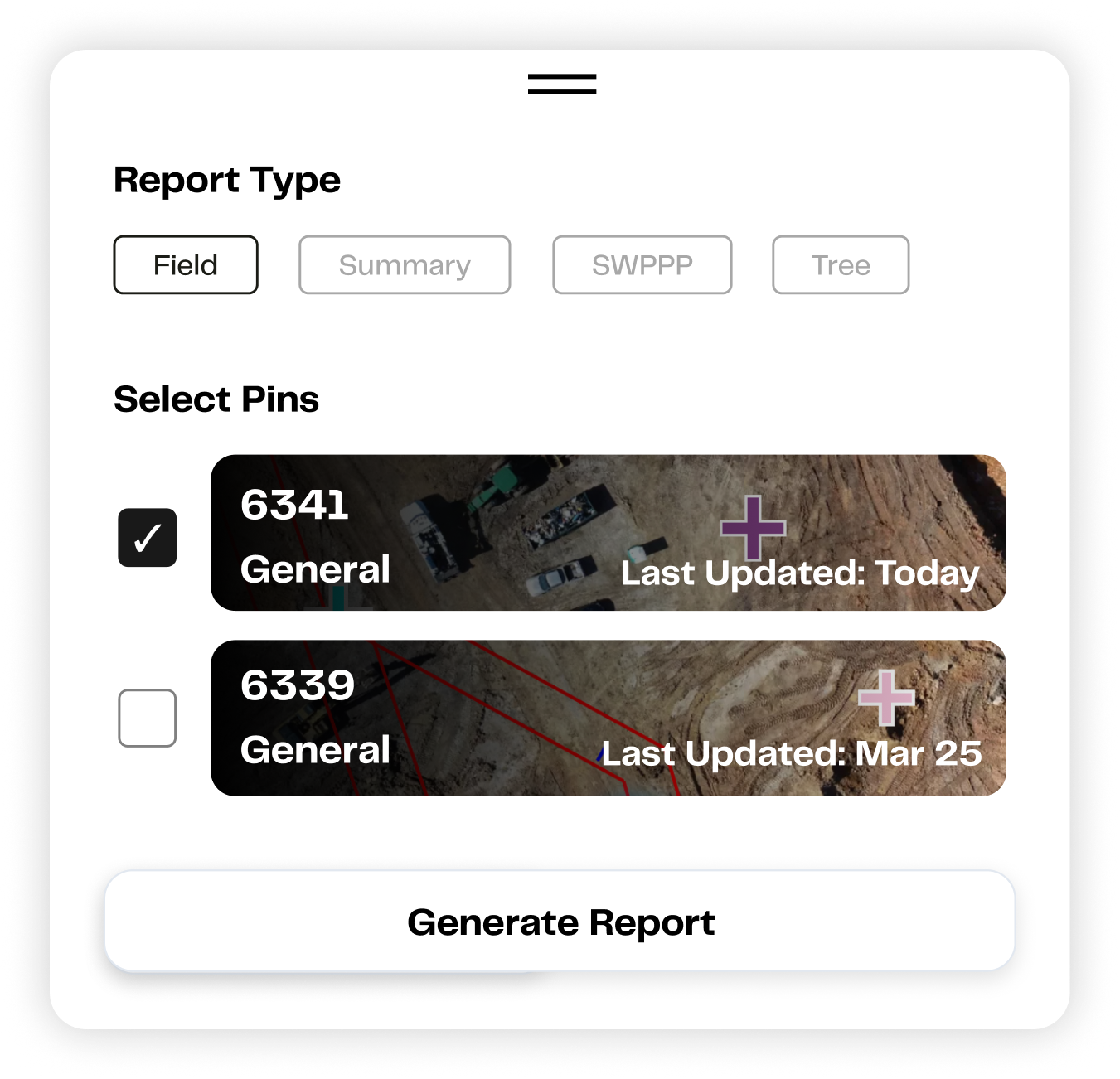
Report
A client-ready report in 15 seconds. No, really.
From field observation to professional deliverable before you leave the parking lot.
SiteMarker generates standardized inspection, progress, and compliance reports directly from your field data: timestamped, geo-referenced, and presentation-ready. SeamonWhiteside cut 45 minutes off every single report. Kimley-Horn reclaimed 200+ hours per project.
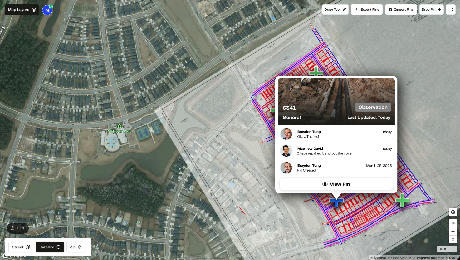
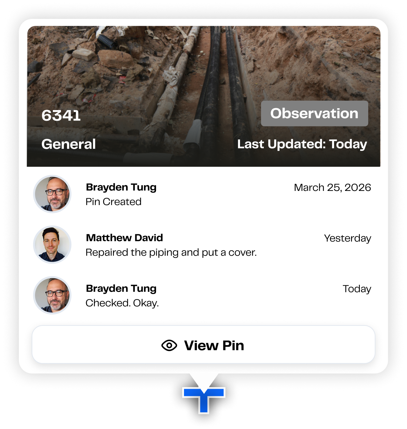
Act
Assign it. Track it. Close it out.
Turn every documented issue into a punchlist item with a location, an owner, and a clear path to resolution.
Spotting a problem is only half the job. SiteMarker lets you assign corrective actions and punchlist items directly from the map, with the photo, the GPS pin, and the notes already attached. Contractors, inspectors, and project managers all see the same information in real time.
Defend
Sleep better knowing your work can defend itself.
Timestamped, GPS-accurate, photo-verified documentation that holds up when it matters most.
Disputes happen. RFIs pile up. Regulators audit. When they do, the question is never 'did you do the work?' It's 'can you prove it?' SiteMarker builds a defensible record of every inspection, every corrective action, and every site condition automatically, as part of the work you're already doing. Before-and-after documentation shuts down false claims. Geo-referenced reports shorten RFI cycles.
Inspection Record: Verified
Timestamp
Apr 14, 2026 · 09:47 AM
GPS Coordinates
32.7765° N, 79.9311° W
Inspector
J. Quick · BJWSA
Observation
Erosion control in compliance
Action Status
Closed, no RFI required
Defensible record generated automatically
Trusted in the field
The results speak for themselves.
0
Average reduction in field documentation time
0
Saved per project
Kimley-Horn
0
Cut from every report
SeamonWhiteside
0
Sites visited per week
Lennar Homes
Where has this been all my career? Now having this as a tool is incredible. And I can't believe we used to do it the way we did.

Samantha Eaton
Landscape Architect, Kimley-Horn
200+ hours saved per project
If you took SiteMarker away and told them to go back to paper right now, half of them would probably quit.
Jason Quick
Senior Construction Manager, Beaufort-Jasper Water & Sewer Authority
700+ annual inspections managed
Ready to see what SiteMarker can do for your team?
Join thousands of construction professionals who document smarter, report faster, and never lose field data again.
Explore by solution